LiDAR & Reality Capture Specialists
SPATIAL INTELLIGENCE FOR COMPLEX ENVIRONMENTS
Survey-led spatial capture for design, engineering, and existing-condition understanding.
Grounded in over 20 years of surveying experience.

WHO WE ARE
SPATIAL CAPTURE GROUNDED IN SURVEYING EXPERTISE
Mach1 Survey & Spatial combines over 20 years of surveying experience with LiDAR and reality capture technologies to deliver accurate, decision-ready information for design, analysis, and project understanding.
We specialise in capturing and structuring data across complex terrain, existing buildings, and constrained environments, supporting architects, geotechnical consultants, engineers, and developers who require reliable existing-condition information to reduce uncertainty and improve early-stage project decisions.
Rather than delivering raw datasets, we focus on clear, structured outputs that integrate directly into design and engineering workflows.
WHAT WE DO
SERVICES and capabilities
Structured spatial data across terrain, structures, and complex environments, formatted for design and engineering workflows.

01
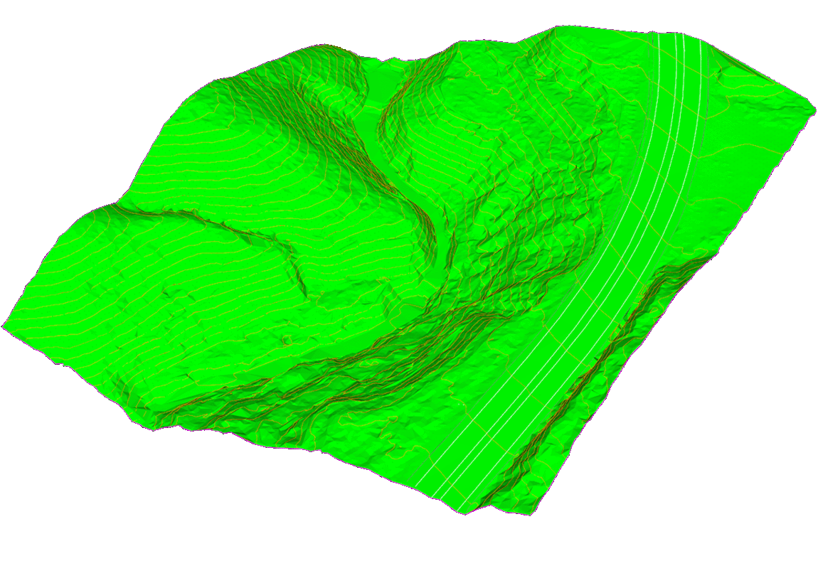
TERRAIN & VEGETATION PENETRATION MODELLING
LIDAR TERRAIN MODELLING & CANOPY PENETRATION
Drone LiDAR for capture of complex terrain, including vegetated and inaccessible environments, with photogrammetry used selectively where appropriate.
01

02
Mobile LiDAR Topographic Surveying
SCAN-TO-CAD DATA CAPTURE
Rapid mobile LiDAR capture for high-density topographic and existing-condition survey data.
01

03
Architectural Existing Conditions
SPATIAL CAPTURE FOR BUILT ENVIRONMENTS
High-resolution capture of buildings and structures for refurbishment, retrofit, and design coordination.
01

04
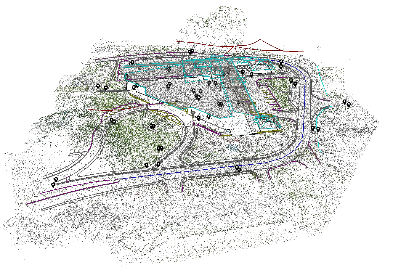
Spatial Data Integration & Visualisation
Integrated 3D Site Understanding
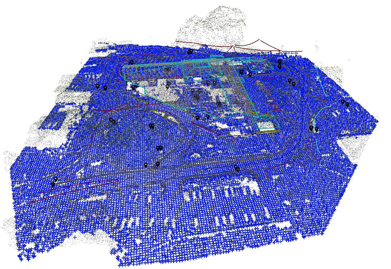
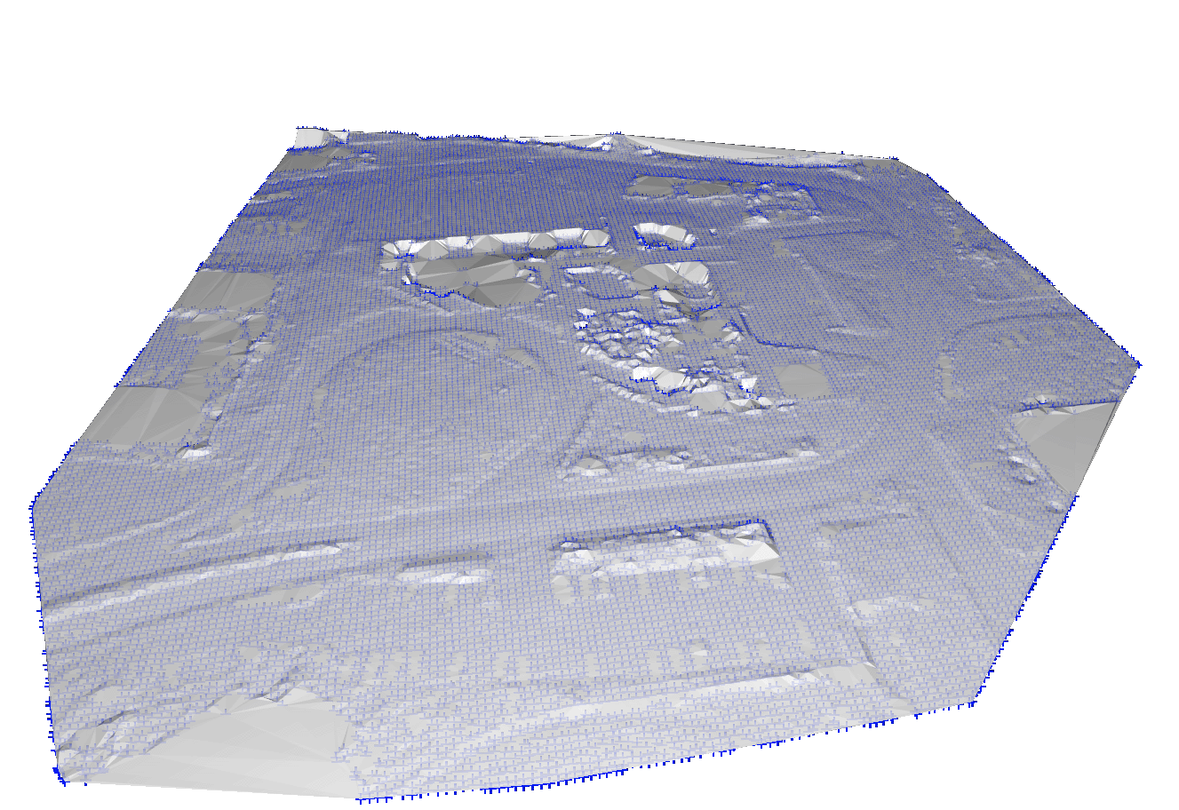
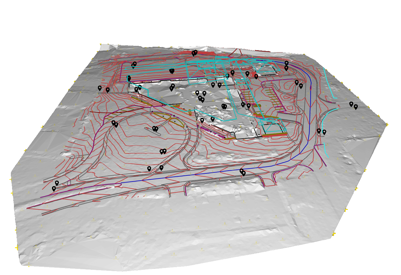
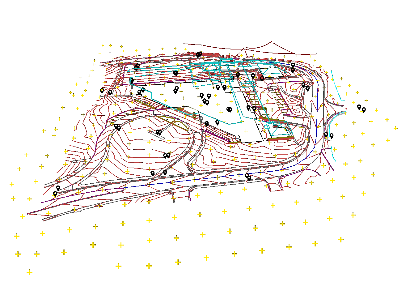
Integration of LiDAR, survey, and existing-condition data into coordinated spatial models and visualisation outputs for design review, analysis, and stakeholder communication. Explore Interactive 3D Model
01
WHY REALITY CAPTURE?
Accurate Spatial Data
Changes Project Outcomes
Modern reality capture provides a higher level of completeness, speed, and spatial understanding than conventional methods alone — particularly in complex terrain, vegetated environments, and existing built conditions.
REDUCED PROJECT UNCERTAINTY
Complete spatial datasets eliminate guesswork in early-stage design and reduce the risk of costly surprises during construction.
IMPROVED DESIGN COORDINATION
Structured outputs that integrate directly into CAD, GIS, and BIM environments ready to use on delivery.
CONFIDENT DECISION MAKING
Clearer understanding of existing conditions and more efficient collaboration between project teams from the outset.

EXPERIENCE & CREDIBILITY
ABOUT MACH1 SURVEY & SPATIAL
Mach1 Survey & Spatial is a survey-led spatial practice delivering LiDAR and reality capture services for complex terrain, existing structures, and design-led projects across New Zealand.
Built on more than 20 years of surveying experience across New Zealand, the United Kingdom, and the South Pacific, our background spans land, engineering and construction surveying, infrastructure, and complex site environments.
We combine modern capture technologies with established surveying principles to deliver accurate, decision-ready outputs for design, engineering, construction, and geotechnical workflows — from point clouds and terrain models through to orthophotos and CAD-ready datasets.
Mach1 operates within Civil Aviation Authority UAV frameworks, with Part 102 certification supporting advanced drone LiDAR operations in complex environments, alongside conventional surveying capability where required.
SELECTED PROJECTS
RECENT WORK
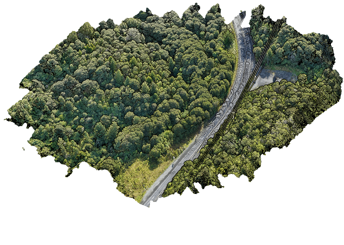
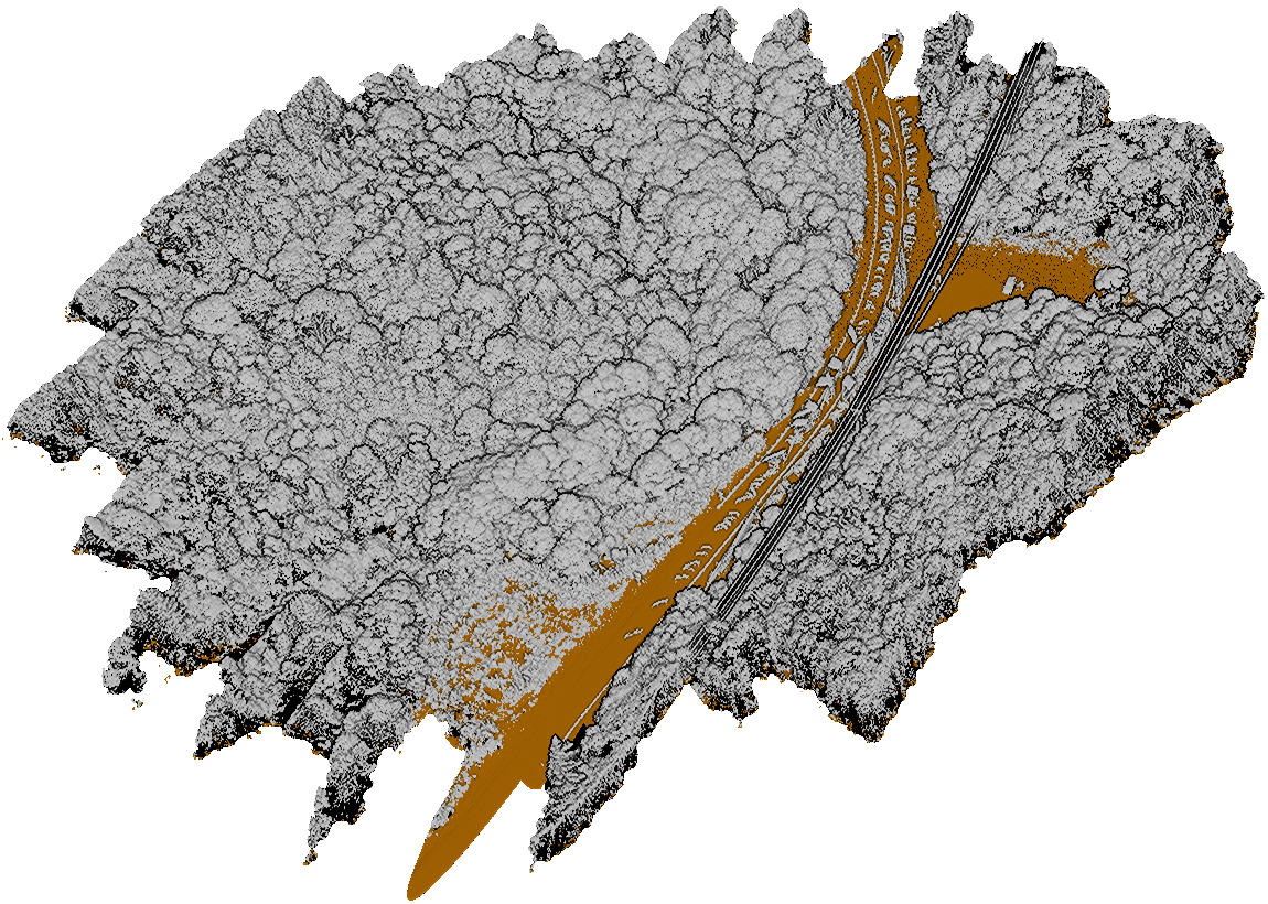
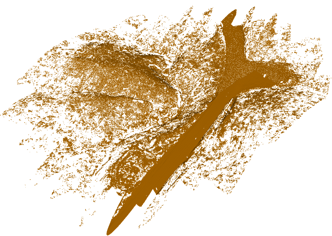
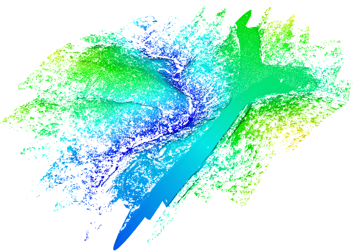
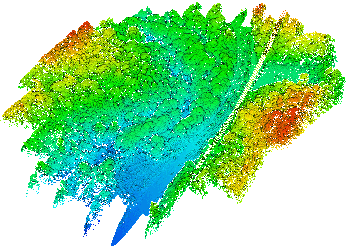
DOME VALLEY, NORTH AUCKLAND
VEGETATED LANDSLIP TERRAIN MODELLING
Drone LiDAR survey undertaken in the Dome Valley region north of Auckland to capture high-resolution terrain data beneath dense vegetation following slope instability within a complex hillside environment near a major highway corridor.
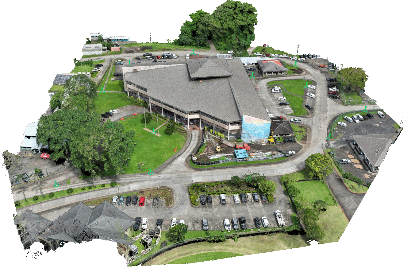
TAURANGA
Architectural Existing Conditions Survey
Mobile and aerial LiDAR survey undertaken across four multi-storey teaching blocks in Tauranga to capture high-resolution spatial data supporting refurbishment design and architectural coordination for building remediation works. Explore Interactive 3D Model
UNDERSTANDING THE PROCESS
FAQS
Answers to the questions we're most often asked about LiDAR survey, reality capture, and our deliverables.
GET IN TOUCH
dicuss a project
For projects involving complex terrain, existing conditions, spatial capture, or conventional survey requirements, please get in touch. We support clients across architecture, engineering, geotechnical, infrastructure, construction, and development sectors throughout New Zealand.
Chris Wellings
Managing Director
PHONE
LOCATION
Auckland, New Zealand
COVERAGE
New Zealand & South Pacific
For accurate pricing, please include as much detail as possible about site conditions, required outputs, and intended use of the data. This helps ensure the most appropriate capture method and scope can be defined from the outset. An indicative budget helps align scope and recommend the most suitable solution.
Thank you for your enquiry.